
Mexico City Districts (Alcaldías, formerly Delegaciones) & Neighborhoods (Colonias) Map
On this page you will find a map of Mexico City's boroughs and neighborhoods. Mexico City is divided into 16 boroughs, its administrative divisions, known since 2018 as alcaldías (formerly delegaciones). Each borough is home to neighborhoods (colonias) that give Mexico City much of its charm and reputation.
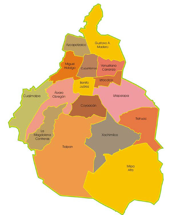
Mexico district map
Mexico City has been divided into 16 boroughs since 1970. Formerly called delegaciones, they became alcaldías in 2018.
The 16 boroughs are:
• Álvaro Obregón
• Azcapotzalco
• Benito Juárez
• Coyoacán
• Cuajimalpa de Morelos
• Cuauhtémoc
• Gustavo A. Madero
• Iztacalco
• Iztapalapa
• La Magdalena Contreras
• Miguel Hidalgo
• Milpa Alta
• Tláhuac
• Tlalpan
• Venustiano Carranza
• Xochimilco