

You can find on this page the map of Mexico city metro. Mexico city metro, subway, tube or underground is a transit system serving the city of Mexico (Mexico) with the urban, suburban & commuter train, the tram, the bus ,the metrobus, the mexibus or the trolleybus. The metro network has 12 lines and 195 stations forming a rail network of 140,7 miles (226,5 km).
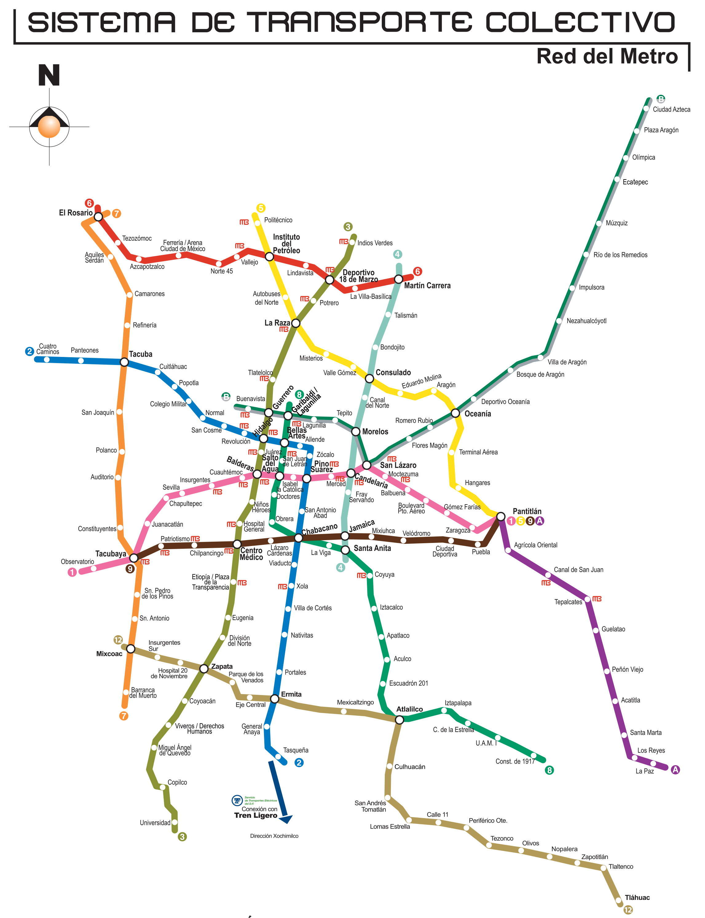
Mexico city subways which transport 4.6 mllion passengers per day, exist since 1969 and are operated by STC (Sistema de Transporte Colectivo).
Its network includes the following 12 lines:
• Line 1 : Observatorio ↔ Pantitlán
• Line 2 : Cuatro Caminos ↔ Tasqueña
• Line 3 : Indios Verdes ↔ Universidad
• Line 4 : Martín Carrera ↔ Santa Anita
• Line 5 : Politécnico ↔ Pantitlán
• Line 6 : El Rosario ↔ Martín Carrera
• Line 7 : El Rosario ↔ Barranca del Muerto
• Line 8 : Garibaldi/Lagunilla ↔ Constitución de 1917
• Line 9 : Tacubaya ↔ Pantitlán
• Line A : Pantitlán ↔ La Paz
• Line B: Ciudad Azteca ↔ Buenavista
• Line 12 : Mixcoac ↔ Tláhuac


